Payson Canyon · Utah County · Family Outdoors
Payson Lakes is what an easy afternoon in the mountains is supposed to feel like.
About twelve miles up the Nebo Scenic Loop from Payson, a small alpine lake sits ringed by pines with a paved trail all the way around it. Picnic tables, two beach-y canoe launches, fishing from shore, ten-degree cooler air than down in the valley. It's the simplest mountain day in Utah County — and it earns its reputation.
We've driven the Nebo Loop a hundred times to get somewhere else. What I want to convince you to do is stop at the lake. Pack a picnic, throw a couple of lawn chairs in the trunk, and just spend the afternoon. You don't need a plan, a trail map, or a permit. You need a sandwich and a tank of gas.
Officially the area is called Payson Lakes — there are a few small lakes in the same basin (Big East is the one most visitors mean), all within a short walk of each other. There are two entrances off the canyon road: the main day-use entrance and a second one through the campground. Both drop you onto the same shoreline.
What's at the lake
A lot of mountain in a very small footprint.
Paved loop trail
About a mile around the lake, flat, shaded, and stroller-friendly the whole way.
Canoe & kayak access
Two small sandy launches. Haul your own — there are no rentals on site.
Fishing from shore
DWR-stocked rainbow trout. Benches and pull-outs around the shoreline.
Picnic & wildlife
Tables, pit toilets, big shady trees. Watch for ospreys, chipmunks, and the occasional moose.
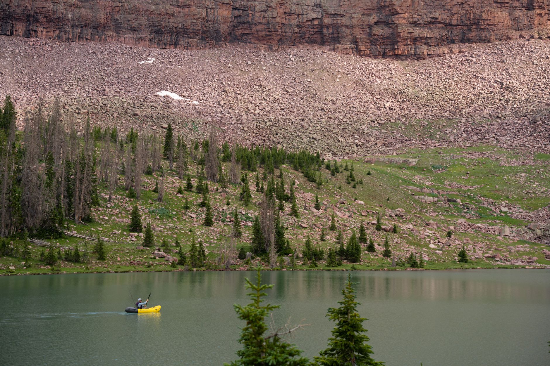
Canoes and kayaks both work — the lake is small, calm, and cold even in August.
Fishing, picnicking, and just sitting there
The whole point is that there isn't much to do.
Utah Division of Wildlife Resources stocks Payson Lakes with rainbow trout through the summer. The shoreline is fully walkable, so a kid with a $20 rod and a tub of PowerBait has a real shot at catching a fish. Bring a license for anyone 12 or older. There are a few sheltered coves where the wind doesn't reach — those are the spots locals fish from.
Picnic tables are spread around the day-use area under the trees. Pit toilets, no running water. Pack out everything you pack in — this is National Forest, not a city park. The chipmunks here will absolutely steal a marshmallow off your knee if you let them. Big kids think this is hilarious. Small kids think it's better than anything Disneyland could produce.
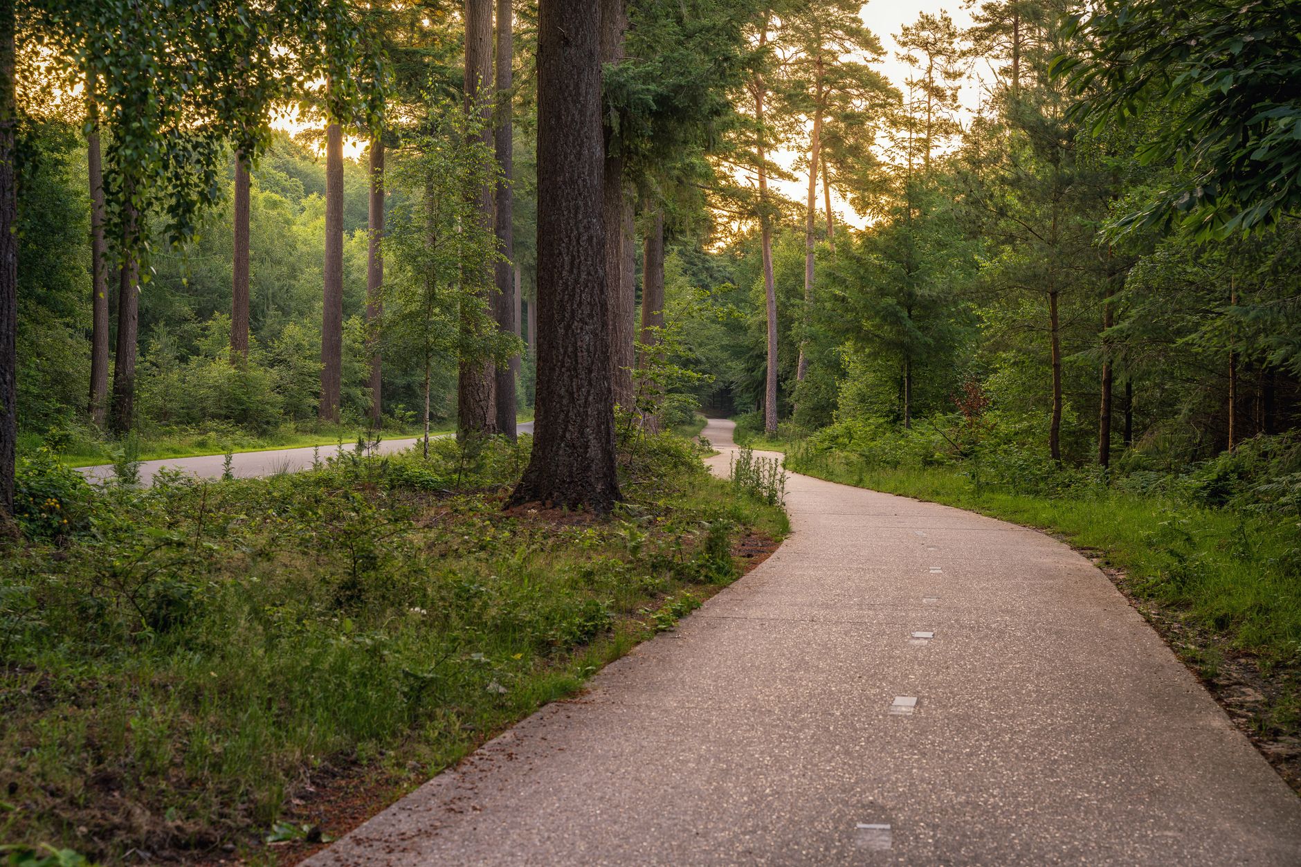
About a mile, flat, paved, and shaded. Easy for everyone.
The loop trail
The most relaxed mile in the canyon.
The paved path runs all the way around the lake — call it a mile, give or take. It stays flat, sits in the shade most of the way, and works for strollers, scooters, walkers, and anyone who doesn't feel like committing to a "real" hike. There's an old split-rail fence on one stretch that turns into the unofficial family-photo spot every fall when the maples and aspens turn.
Keep your eyes open. People regularly see ospreys diving for fish, deer slipping through the trees at the far end of the loop, and sometimes — really — a moose at the water's edge in the early morning or late evening. Give moose a wide, wide berth. They look like cows, but they're not.
When the road is open
Memorial Day to mid-October, weather depending.
The Nebo Loop is closed in the winter and most of the spring — snow lingers at this elevation well into June some years. The gate usually opens around Memorial Day weekend and closes when the first real storm of fall hits, typically late October. The Forest Service posts a status page; check it before you drive, especially early and late in the season. Fall foliage here, when you time it right, is legitimately one of the best drives in Utah.
Practical details
Know before you go.
- Location
- About 12 miles up Payson Canyon on the Nebo Scenic Loop (Forest Road 015)
- Day-use fee
- Cash at the entry station, or America the Beautiful / Interagency Pass
- Season
- Late May through mid-October (canyon road closes in winter)
- Loop trail
- ≈ 1 mile, paved, flat, ADA- and stroller-friendly
- Boats
- Canoes, kayaks, paddleboards welcome — no motors, no rentals on site
- Fishing
- Stocked rainbow trout. Utah license required for ages 12+.
- Restrooms
- Vault toilets at the day-use area
- Dogs
- Allowed on leash — this is a dog-friendly canyon
- Cell service
- Spotty to none. Download maps before you leave town.
- Elevation
- ~ 8,000 ft — pack a layer, even in August
How to get there
From the valley.
From I-15, take Exit 254 (Payson Main St) and head east through town. Follow the brown Nebo Scenic Bywaysigns onto 600 E / Canyon Road and just keep climbing. The day-use entrance is on your right about 12 miles up — you can't miss the big brown Forest Service sign.
From Salem or Spanish Fork it's a 30-minute drive. From Nephi it's closer to an hour — north on I-15, then up the canyon. Pair it with a Grotto Falls hike on the way up and you've got a full unrushed day.
Why I bring buyers up here
South Utah County has a backyard most people don't know about.
When clients ask me what "living in Payson, Salem, or Spanish Fork" actually gets them on top of a house, this is part of the answer. The Nebo Loop is twenty minutes from your driveway. You can leave work at 5:30 and be eating a sandwich next to an alpine lake by 6:15. That's not most places. Worth knowing before you decide where to plant.
